

Even though I have borrowed several elements from medieval maps I should probably tell you that the map I made only faintly resembles some of the known medieval maps. In medieval time the maps were far from acurate and some where even only conceptual. Most of the maps I was able to find actually dates to the earliest years of the renaissance (from a South European point of view).
There were a difference between the maps supposed to be used for navigation and maps simply made for the artistic purpurses. Others were plastered with religious symbols, like angels.
The so called wheel or T maps weren't accurate. They portraid the world as divided in 3, Asia, Africa and Europe. Jerusalem was at the center of the world and as you can see Asia and Arabia are drawn like they are the northern part of the world. If you twist your head to the left you get a "normal" idea of the world.
 |
| Nordic map from around 1300. |
Here you can see the Danish peninsula Jutland and how it develops in the maps:

Ptolemaius 200 AD

Nicolaus Donis 1482 AD

Olaus Magnus 1539 AD
The arrival of book printing technic in the 1400's in Europe was of great importance to the the map production. First they used wood to make and duplicate maps and later they were etched in cobber. The details of the late medieval maps are amasing, and it's those maps who inspired my seating chart:

 |
| Seamonster detail from map by Jacob Ziegler, 1532 |
 |
| 1300's Matthew Paris |
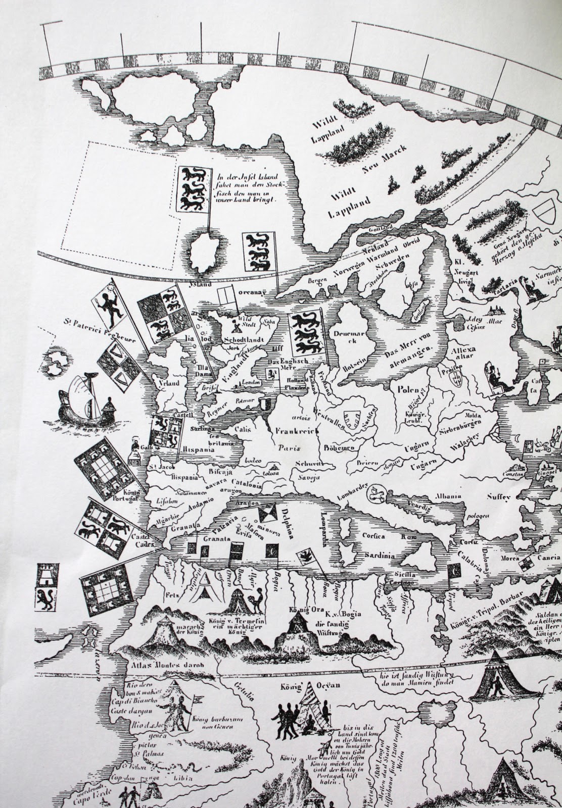 |
| 1492, same year as Columbus discovered America. It's part of a world map by Martin Behaim. I love this one, with the heraldic flags and little details like the ship to the left. |
 |
| 1491, Nicolaus Cusanus - Northern Germany and Denmark |
I realy like the map idea! We have 6 tables as well :D The house where we will have our wedding at is build in 1656. So that isn't a medieval age, but i thought i will use your idea by finding the map of the arrea of that time and put our table seating there with animals or subjects that our city was famous for at that time :D
ReplyDeleteI am realy into history, and what a better way to have some history and celebration together ^^
Thank you for fantastic posts, keep them coming <3
Thank you so much Katherine. It's so nice to hear that I inspired you! :) I still have some ideas to post ;)
ReplyDeleteMark is going to make us a map of the area to put in our invitations, I shall have to point him here to give him some inspiration!
ReplyDeleteSounds amasing, :) I have like 10 maps more if he wants more inspiration, just write me. :)
Delete